The Canal's Past
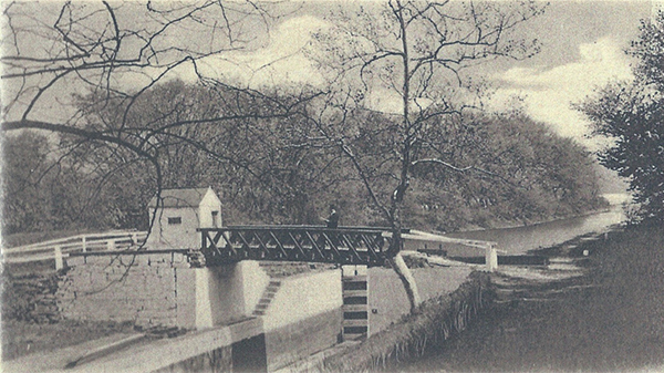
Lock 60, Schuylkill Canal, Mont Clare, PA. Photo courtesy PhoenixvilleFoundry.org
The canal's original name was Oakes Reach. A "reach" is the flat water of a canal between two locks. Thomas Oakes was the Schuylkill Navigation Company's first principal engineer and the canal's designer in 1820. Both Oakes and his successor died a few years later from the "plague" that swept field crews working on the navigation under primitive conditions that can only be imagined today.
It originally flowed for three and a half miles from Lock 60, just below Black Rock Dam (which still stands) past the settlements of Quincyville (now Mont Clare) and Jacobs (later Lumberville), to Lock 61 at Oaks, where it entered the upriver end of the dam pool created by Pawlings Dam and the junction of Perkiomen Creek and the river.
The Company Behind the Canal
The Schuylkill Navigation Company was chartered by the Pennsylvania Legislature on March 8, 1815, with a mandate to improve the Schuylkill River for commercial transport. The system, completed in 1827, stretched 108 miles from Philadelphia to Port Carbon in Schuylkill County, using a combination of 62 miles of dug canals and 46 miles of slackwater pools held back by dams. Its 92 lift locks raised and lowered boats a total of 610 feet from tidewater to the coal region.
Cadwalader Evans served as the company's first president from 1815 until 1830. Edwin F. Smith, who joined as an engineer and rose to superintendent and general manager, guided operations for nearly five decades and became the most consequential figure in the navigation's day-to-day history.
The company's purpose was coal. Anthracite from the mines around Pottsville and Port Carbon had no practical way to reach Philadelphia's furnaces and homes until the navigation opened. From 1828 to 1841, the Schuylkill Navigation held a virtual monopoly on that trade, and the revenue it generated transformed the region. By 1841, boats were carrying more than 737,000 tons of coal annually through the system.
The peak came in 1859, when approximately 1,400 boats worked the canal, each carrying around 180 tons. That year the system moved 1,699,101 total tons, of which 1,379,109 were anthracite coal. It was an extraordinary industrial achievement for an era before steam-powered rail dominated freight.
But the railroad was already winning. The Philadelphia and Reading Railroad had opened in 1841, and within a few years it was carrying three times as much anthracite to Philadelphia as the canal. Floods, droughts, winter freezes, and accumulating silt made the canal expensive to maintain. In 1870, after decades of mounting losses, the company leased the entire navigation to the Philadelphia and Reading Railroad for 999 years.
Under railroad control, traffic collapsed. By 1890 only 144,994 tons passed through the system. Sections above Port Clinton were abandoned in 1891. The last commercial cargo moved through the lower Schuylkill Navigation in 1931. The Commonwealth of Pennsylvania acquired the company in 1949, and the 1950s desilting project filled in much of what remained.
Schuylkill Navigation Company
A commercial powerhouse of its era
1815
Company chartered
108 mi
Total length
1.7M
Peak tons (1859)
1,400
Boats at peak
Late 19th to Mid-20th Century
By the time the Schuylkill Navigation Company leased its system to the Philadelphia and Reading Railroad in 1870, commercial traffic was already in serious decline. The railroad had been moving three times as much anthracite as the canal since the 1840s, and repeated floods and droughts had left the infrastructure battered. The upper navigation above Port Clinton was formally abandoned in 1891. By 1904, anthracite traffic on the remaining lower stretch had almost completely ceased, and after 1913 only occasional cargo moved at all. The last commercial boat made the journey in 1917.
While commerce wound down, leisure gradually took its place. By 1915, most of the roughly thirty boats still using the canal were pleasure craft. The quiet waterway — shaded, flat, and removed from the noise of the new century's roads and railways — became an amenity rather than an artery. Pleasure boats made excursions upriver from Philadelphia, and in Port Providence and Mont Clare, nearly every backyard that backed onto the canal had a small dock with a canoe or rowboat tied to it.
The canal's survival in the Mont Clare reach owes a great deal to community advocacy. When the Schuylkill River Desilting Project was launched in the late 1940s as a federal and state response to the century of coal silt choking the river, the project threatened to fill the canal entirely. Residents of Mont Clare and Port Providence successfully pushed back, and the upper portion was kept watered for recreation. The lower mile was filled in, ending the reach at Longford Road, where a small stream now returns the canal water to the river.
Black Rock Dam, built by the Schuylkill Navigation Company to impound the slackwater pool that fed the canal at Lock 60, still stands today just below the lock. In 1902, the Reading Traction Company added three hydroelectric generators to its forebay to power local trolley service. In 2008, a fish ladder was constructed on the Chester County side of the dam as part of an American shad restoration effort on the Schuylkill River.
Schuylkill River Desilting Project
A first-of-its-kind environmental cleanup
1947
Project began
$55M
Total cost
30M+
Cubic yards removed
5
Canal dams demolished

The restored Lock Tender's House at Lock 60, photographed during Canal Day 2008. Photo: J Clear, CC BY-SA 3.0
The SCA Story
The canal meant a great deal to the people who lived around it. When the state considered simply filling it in, township supervisors created the Schuylkill Canal Advisory Committee, local citizens exploring how the canal might be saved without great taxpayer expense. They quickly organized widespread community support for maintaining the canal with volunteers.
In 1983, Upper Providence signed a 25-year lease to the area. In 1985, the volunteer citizens incorporated as the Schuylkill Canal Association, already with some 200 dues-paying members. The current lease is with Montgomery County.
In 1996, after Governor Ridge declared the Schuylkill a state heritage corridor, the Association was awarded Montgomery County's first heritage corridor implementation grant. That year, two 12-foot-wide cement plank canoe launches were built into the river, the first of many ongoing restoration projects.
The Association now divides its energies between maintaining a much-used recreation area and its multi-year project of recreating a canal-era setting at the site. The Locktender's House has been restored, trails cleared, picnic groves established, and canoe launches built, all with volunteer labor and community support.
Timeline
Schuylkill Navigation Company chartered by the Pennsylvania Legislature
Thomas Oakes designs the canal; construction begins on Oakes Reach
Navigation system completed: 108 miles from Philadelphia to Port Carbon
Lock 60 is doubled: two side-by-side lock chambers replace the original
Philadelphia and Reading Railroad opens, beginning direct competition with the canal
Peak year: 1.7 million tons transported, with roughly 1,400 boats in operation
Navigation system leased to the Philadelphia and Reading Railroad for 999 years
Upper navigation above Port Clinton abandoned; anthracite traffic nearly gone by 1904
Last commercial boat makes the journey; recreational use of the canal grows
Schuylkill River Desilting Project begins; community advocacy preserves the upper canal
Lower mile of Oakes Reach filled in; canal now ends at Longford Road
Upper Providence Township signs a 25-year lease to preserve the area
Schuylkill Canal Association incorporated with 200+ charter members
First Montgomery County heritage corridor grant; canoe launches built
SCA continues restoration and serves 25,000+ visitors annually
Lock 60 is open to the public year-round. Walk the towpath, visit the Locktender's House, or join us at one of our events.